Mapping-Events in your Region
Gathering accessibility data through civic engagement – preparation, execution and evaluation of mapping-events.
Mapping-events in your region
How can we achieve the goal of a more inclusive and more accessible hometown together? With mapping-events, for example, during which locals use the Wheelmap to mark the accessibility of public places in your city or town.
With the Mapping-Event Planner we have developed a tool with which cities and towns can plan, carry out and evaluate events for rating the accessibility of places. Events can be created and evaluated and participants invited to take part in the mapping. Standard questionnaires for rating the accessibility of places in detail are available, as well as ones that can be individually customized. The Mapping-Event Planner comes with your own logo and and in your chosen design.
Many city administrations, educational institutions and organizations have already created their own “MapMyDay” events using the Wheelmap. Of course we would be happy to support you in creating your own professionally organized campaign.
Examples

In the Böblingen district in southern Germany a large mapping event was carried out in 2016 with 26 classes from 20 different schools. After only two weeks the students had already rated 700 places and public toilets on their accessibility, as well as having added photos and comments.
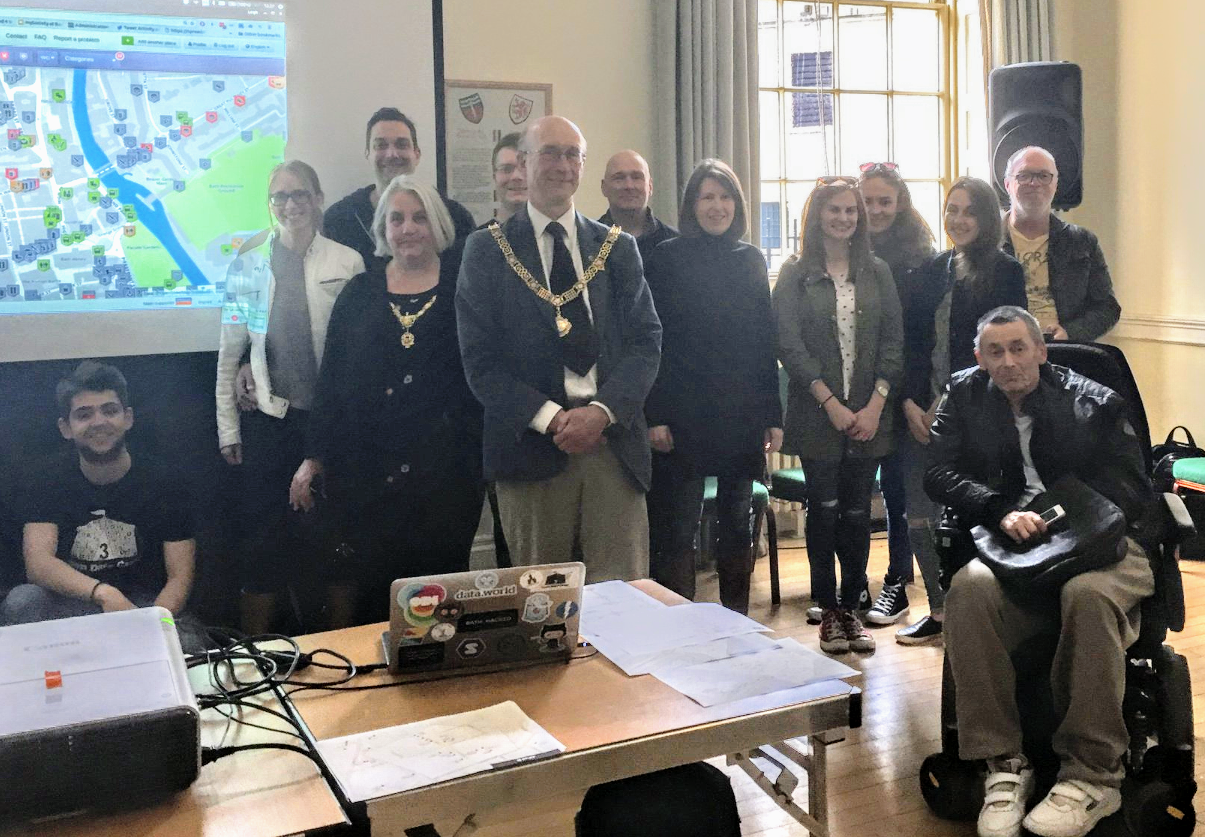
More than 20 volunteers and the mayor of the English town of Bath carried out a mapping event during which they added 300 newly rated places to the Wheelmap. The percentage of places that have been rated in Bath thereby rose from 33 to 57 percent – in just one afternoon. In addition, the website “Accessible Bath” was called into life, where the growing number of rated places in the town is constantly updated.
An overview of other mapping events can be found here.
Our other solutions

The map for accessible places in your region – with customized accessibility criteria and branding.

Portable ramps to easily bridge one or two steps, without any structural changes being necessary.

Real-time information on the operational status of elevators in train stations and public places.
Standardized accessibility information on public places brought together on one platform.

Conceptual advice, booking of models with a disability, production of inclusive photos und a photo database.