Partnerships for Accessibility Data
Creating more value with collected data – worldwide sources of accessibility data standardized on one platform.
Partnerships for accessibility data
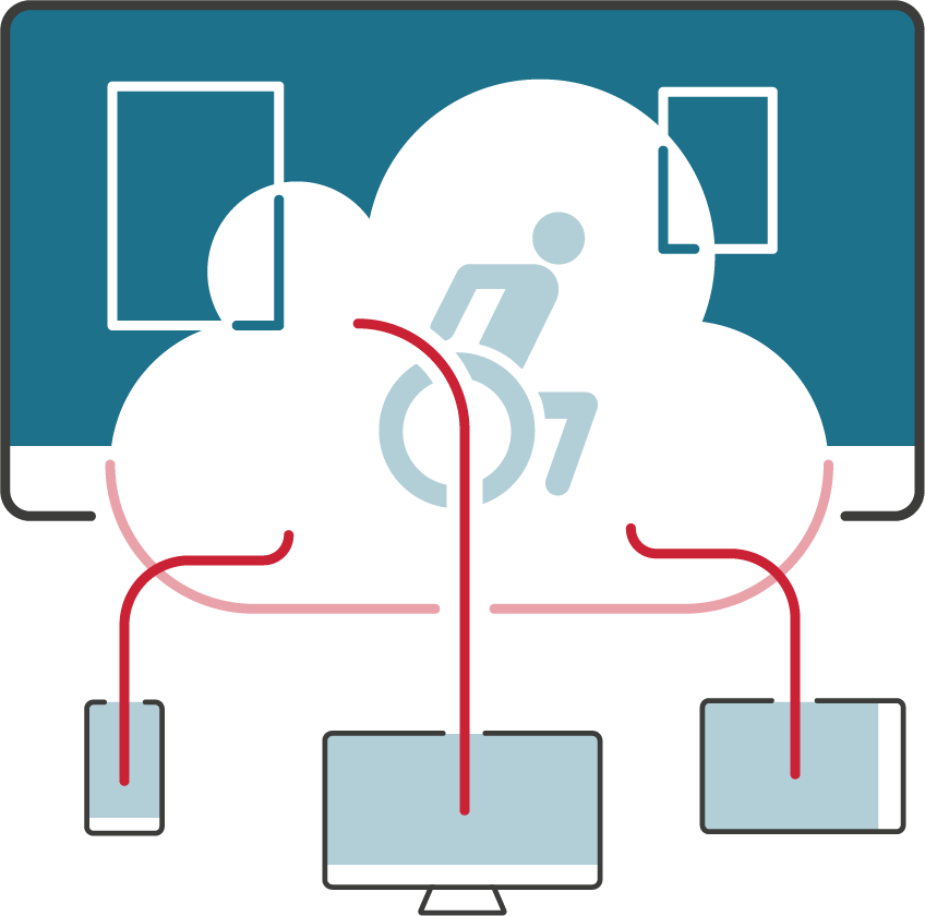
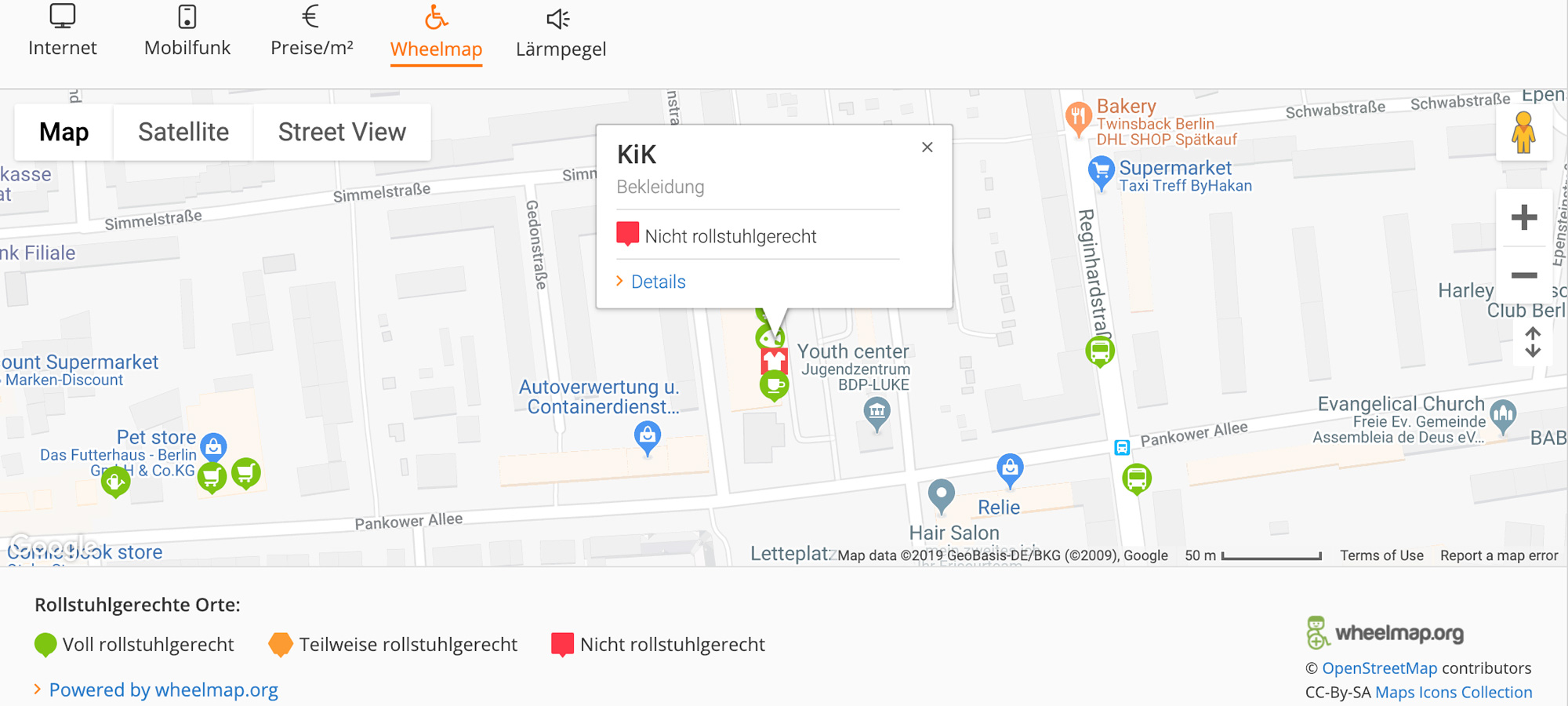
With the Accessibility Cloud we have developed a comprehensive tool, that is able to bring together location-based information and ratings from different accessibility databases and apps onto one platform. This information is connected to the Wheelmap database and shows up on the online map. Places from the Wheelmap can also be shown in the other participating apps. In this way different user groups from all over the world can benefit a great deal from the shared information.
The Accessibility Cloud technology allows us to recognize data sets from a wide variety of sources and in differing formats and to harmonize them into one format. In this way, for instance, detailed information about a public place can be shown alongside the operational status of elevators.
Has accessibility information already been collected in your region? Perhaps the data has been collected in differing formats and on various databases? By becoming an Accessibility Cloud partner these data sets can be harmonized and shown together with other accessibility information on platforms such as Wheelmap. The source of your data will always be clearly cited so that it is obvious to users where the data comes from.
The Accessibility Cloud database currently unites accessibility information on more than 2 millionen public places from 100+ sources. The project was initially supported by a Google.org grant and its project partners include Foursquare and HERE Technologies.
Examples
The recently launched Mercedes-Benz project “WheelPilot” makes use of accessibility data from the Accessibility Cloud.
In order to be able to offer its customers navigation to accessible locations in the future, the innovation department of the Daimler AG, LAB1886, has started the project “WheelPilot”. In the development of the prototype the automobile giant uses data from the Accessibility Cloud. The product is currently being tested by Mercedes-Benz employees.
“In the long run it will be integrated into the map function of Mercedes Me, Mercedes-Benz’s digital automotive app. The driver can then inform himself beforehand via his Smartphone how to get to his chosen location, if the location is wheelchair accessible and even, if there is a wheelchair accessible restroom there – say good-bye to barriers.”
– Matthias Heil (Manager LAB1886, Daimler AG)
Every apartment listing on the real estate platform ImmobilienScout24 shows a map with the exact location of the apartment. This map now also has a button with a wheelchair symbol: with a click the colored Wheelmap icons that give information on the accessibility of public places become visible in the apartment’s direct vicinity.
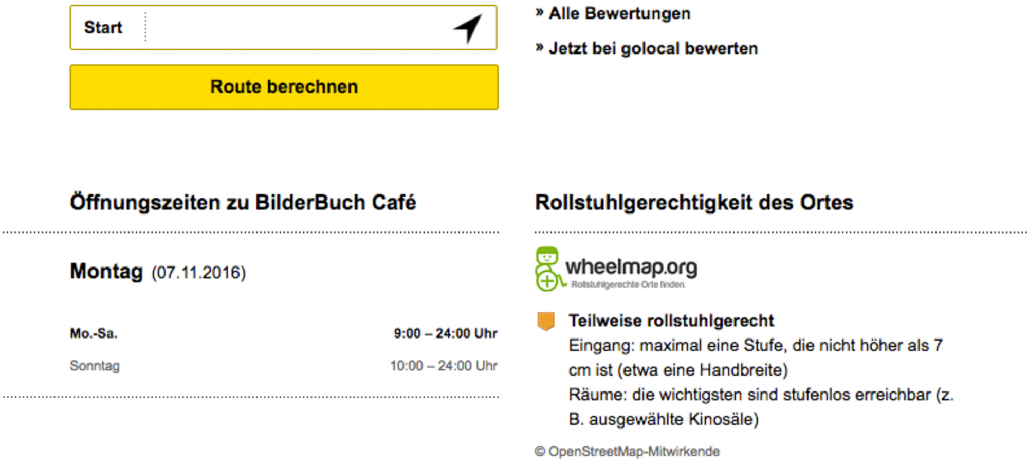
The German Yellow Pages directory Gelben Seiten has integrated the data from Wheelmap and Accessibility Cloud into their service. With this, an important milestone of our vision has been reached: that accessibility data be readily available in the same places where people regularly look for other location-based information.
Our other solutions

The map for accessible places in your region – with customized accessibility criteria and branding.
Preparation, Execution and Evaluation of Mapping Events for rating the accessibility of places.

Portable ramps to easily bridge one or two steps, without any structural changes being necessary.

Real-time information on the operational status of elevators in train stations and public places.

Conceptual advice, booking of models with a disability, production of inclusive photos und a photo database.